
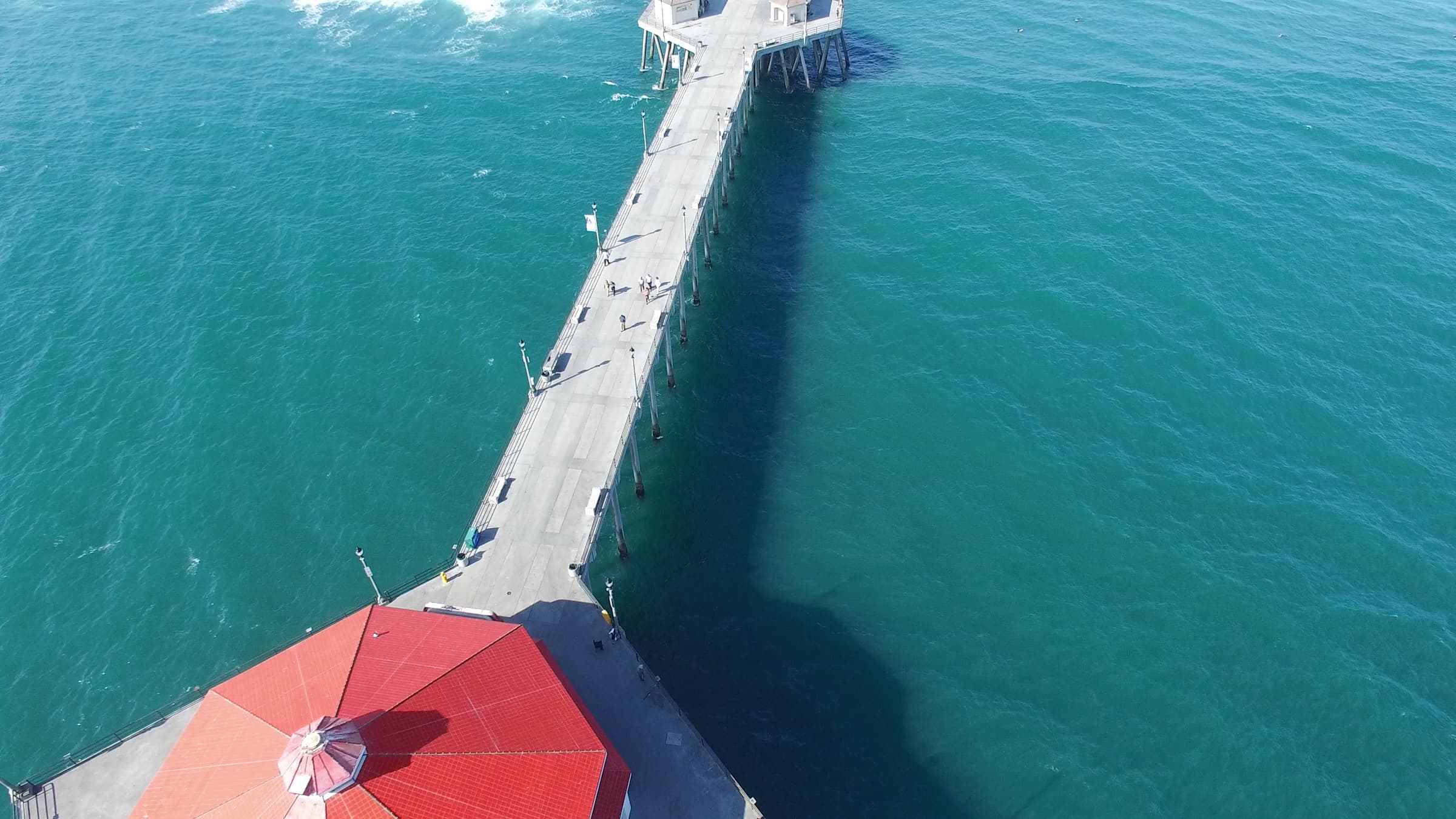
Living in South Huntington Beach: Area Guide
A local, property-focused look at the southern section of Huntington Beach, its tract neighborhoods, river-mouth recreation, and commuter geography.
Direct answer
Living in South Huntington Beach means established inland tracts near the Santa Ana River, Huntington State Beach, and quick access to the 405 and John Wayne Airport in southeast Orange County.
Updated 2026-10-11
Where is South Huntington Beach and what defines it?
South Huntington Beach is the southeastern section of the city, the part that runs down toward the Santa Ana River and the Costa Mesa and Newport Beach border. Generally you can picture it as the area south of Adams Avenue and east toward the river, bounded by Pacific Coast Highway on the ocean side and the river channel on the far side. Much of this part of town falls in ZIP 92646, with some overlap into 92648 closer to the center of the city.
What sets South HB apart from the harbor neighborhoods to the north or the Downtown core is its layout. This is largely flat, grid-planned, post-war and mid-century suburban development, built out tract by tract from the 1950s through the 1970s. The streets are wide, the lots are consistent, and the blocks are organized around schools, parks, and the main arterials of Brookhurst, Magnolia, Bushard, and Hamilton.
Because it sits at the mouth of the Santa Ana River, this corner of Huntington Beach also has a different relationship to open space than the rest of the city. You have the river trail on one edge, Huntington State Beach along the coast, and the wetlands and river channel knitting the area together. Justin Ratowsky grew up in Huntington Beach and has lived in several of its neighborhoods, so the team at Ratowsky Group treats these distinctions as real rather than cosmetic.
What is it genuinely like day to day in this part of town?
Daily life in South Huntington Beach leans practical and low-key. The housing is set back from the tourist-heavy Downtown and Main Street scene, so the pace feels more residential and routine. You run errands along Brookhurst and Adams, you reach the sand without crossing the whole city, and you move between the inland tracts and the coast on a predictable grid.
The coastline here is the state beach rather than the pier. That means long, wide sand, dedicated parking lots, fire rings, and the river-mouth surf break instead of the boardwalk density you find near the pier. For a lot of people, that trade is the appeal: beach access without the summer crush of the Downtown blocks.
Inland, the texture is quiet suburban. Cul-de-sacs, two-car garages, mature street trees, and neighborhood parks are the common thread across most tracts. If you want to understand how the different sections of the city feel against each other, the broader Huntington Beach communities overview is a useful starting point before you narrow in on the south end.
What neighborhoods and tracts are in South Huntington Beach?
South Huntington Beach is not one neighborhood. It is a patchwork of named tracts, most of them platted during the mid-century build-out and organized around the main arterials. Rather than thinking of it as a single zone, it helps to picture the pieces.
Here are the recognizable building blocks of the area, framed by geography and housing stock rather than by who lives there:
- The Adams corridor tracts, the established single-story and two-story homes clustered around Adams Avenue as it runs toward the coast.
- Dutch Haven and the older marina-adjacent tracts, among the earlier south-end developments with their own street character.
- The grid neighborhoods between Brookhurst Street and Bushard Street, dense with consistent 1960s and 1970s single-family tracts.
- The Magnolia and Hamilton corner closest to the river mouth, where homes sit nearest Huntington State Beach and the Santa Ana River Trail.
- Pockets of townhome and condominium communities layered in among the single-family tracts, often along the larger arterials.
- Homes backing the Santa Ana River channel and the trail, which carry their own view and recreation considerations.
How close is South HB to Huntington State Beach and the river mouth?
Proximity to the coast is one of the defining features of South Huntington Beach. Huntington State Beach stretches along the southern coastline of the city, from roughly Beach Boulevard down to the Santa Ana River mouth at the Newport Beach line. For many south-end tracts, the beach is a short drive rather than a cross-town trip.
The state beach itself is run by California State Parks and offers paved parking lots, restrooms, fire rings, a bike path along the sand, and a long uninterrupted stretch of shoreline. The river-mouth zone where the Santa Ana River meets the ocean is a known surf area and a transition point into the Newport Beach side at the Santa Ana River jetties.
If coastal proximity is a priority in your search, it is worth understanding how beach access, parking, and the different stretches of shoreline shape value. The neighborhoods nearest the state beach trade differently than the inland grid, and the team walks through those distinctions directly with buyers weighing a south-end move.
What outdoor recreation sits along the Santa Ana River?
The Santa Ana River defines the eastern edge of South Huntington Beach, and the Santa Ana River Trail runs alongside it. The trail is a paved multi-use path that follows the river channel inland for many miles, connecting riders and walkers from the coast toward the inland cities upstream. It is a genuine piece of regional infrastructure, not just a neighborhood sidewalk.
At the coastal end, the river mouth and the adjacent wetlands create a band of open space and bird habitat. The combination of the river trail, the state beach bike path, and the flat grid streets makes this a straightforward area to move around on a bike or on foot for recreation.
Between the river corridor, the state beach, and the neighborhood parks tucked into the tracts, South HB has a recreation profile built around water and open space rather than around nightlife. That orientation toward the outdoors is part of what people are describing when they ask what it is like to live here.
What is the commute geography like from South Huntington Beach?
Commuter access is a practical strength of South Huntington Beach. The area sits close to the southeastern edge of the city, which puts the 405 freeway and the arterial routes toward Costa Mesa and the 55 freeway within a reasonable reach. Beach Boulevard, Brookhurst, and Adams all feed toward those connectors.
John Wayne Airport in Santa Ana is one of the closer commercial airports to this part of Orange County, reachable by way of the 405 and the 55. For anyone who travels for work, that relative proximity is a real factor in the south end versus the harbor neighborhoods farther north.
The Costa Mesa and Newport Beach border also means the employment and shopping centers of those cities, including South Coast Plaza and the Newport business corridors, are nearby by car. Commute realities change by exact tract and by time of day, so the practical move is to test your own drive at the hours you actually travel.
What does the housing stock look like in South HB?
The housing in South Huntington Beach is predominantly single-family tract homes from the mid-century build-out, with a layer of townhomes and condominiums mixed in along the larger streets. Floor plans tend to be practical: single-story ranch layouts and two-story plans with attached two-car garages on consistent lots.
Because so much of the area was built in the same era, many homes have been renovated over the decades. You will see original condition houses alongside fully remodeled ones on the same block, which creates a wide range within a single tract. That variation is where pricing strategy and condition assessment matter most.
If you are weighing a condominium or townhome in the south-end communities, the Huntington Beach condo guide covers the building and HOA questions that come up, and the HOA document review guide walks through what to read before you commit. For single-family buyers, the buying a home in Huntington Beach guide lays out the process end to end.
How does South Huntington Beach compare to other parts of the city?
It helps to place South HB against the rest of Huntington Beach rather than describing it in isolation. Each section of the city has a distinct layout and relationship to the coast, and the differences are concrete.
The comparison below is about geography and housing character, not about people:
- South Huntington Beach: inland grid tracts and coastal tracts near Huntington State Beach, the Santa Ana River Trail, and the Costa Mesa and Newport border, with strong freeway and airport access.
- Downtown and the pier area: denser, walkable blocks near Main Street, a mix of older homes and newer builds, and the highest tourist activity.
- Huntington Harbour and the north end: waterfront and harbor-channel homes with docks, a boating orientation, and higher trophy-home pricing.
- Central Huntington Beach: large-lot interior tracts near Central Park and the library, set back from both the coast and the river.
What should you know before buying or selling in South HB?
Because South Huntington Beach spans so many tracts, pricing is local down to the block. A remodeled home near the state beach and a similar-sized original home several streets inland can sit far apart in value even inside the same ZIP code. Model-match comparisons, lot size, condition, and distance to the coast all move the number.
For sellers, that variability is exactly why presentation and positioning matter. Ratowsky Group uses a staged approach, from a private exclusive phase to a broader demand campaign to a timed market release, to build interest before a home goes fully active. You can start with a confidential home value review and read through the selling timeline guide to understand the sequence.
For buyers, the move is to get specific early about which part of the south end fits your priorities, whether that is proximity to Huntington State Beach, access to the Santa Ana River Trail, or the shortest drive to the 405. First-time buyers can start with the first-time buyer guide, and anyone can reach the team directly through the contact page to talk through specific tracts.
Should you check flood zones near the Santa Ana River?
Because South Huntington Beach borders the Santa Ana River and the coast, flood zone status is a reasonable thing to confirm during a home search. Flood designations are set parcel by parcel, not by neighborhood, so you cannot assume a home's status from its general location near the river or the beach.
The practical step is to look up a specific address on the FEMA Flood Map Service Center before you rely on any assumption. Flood zone designation can affect insurance requirements and should be verified for each property rather than generalized across a tract.
Ratowsky Group can point you to where to confirm these details, though the team is not an insurance or legal advisor. For property-specific questions, confirm with the appropriate licensed professional and use official records rather than boilerplate.
Frequently asked
Living in South Huntington Beach: Area Guide, the questions we hear first.
What neighborhoods are in South Huntington Beach?
Is South Huntington Beach close to the beach?
What ZIP code is South Huntington Beach?
How far is John Wayne Airport from South Huntington Beach?
What kind of homes are in South Huntington Beach?
Is South Huntington Beach in a flood zone?
Your Huntington Beach real estate team
Craig and Justin Ratowsky.
Craig Ratowsky and Justin Ratowsky are equal partners at Ratowsky Group, principal agents with Compass, and founding members of the Compass Huntington Beach office. Craig has sold Huntington Beach real estate since 1977, bringing 49 years of pricing and negotiation experience. Justin is a third-generation California Realtor® focused on local guidance and modern marketing. Together, they bring 58+ years of combined experience.
Sources & local citations
Qualitative claims framed as agent insight reflect Ratowsky Group’s direct experience and are not represented as third-party verified data.
Start the search
Thinking about a move to South Huntington Beach?
If you want to understand how the south-end tracts near the Santa Ana River and Huntington State Beach compare, Craig and Justin Ratowsky are happy to have a local, no-pressure conversation and help you narrow in on the right block. Reach the team through the contact page whenever you are ready.
Ratowsky Group at Compass. Craig Ratowsky DRE #00608046, Justin Ratowsky DRE #02026158. Guidance is general market context, not a valuation, tax, or legal advice.