
Best Walking and Biking Trails in Huntington Beach
A practical, local guide to Huntington Beach's paved beach path and quiet nature trails, with distance, difficulty, parking, access, and where to rent bikes.
Direct answer
Huntington Beach's best walking and biking trails include the 8.5-mile beach path, the Bolsa Chica Reserve loop, Central Park trails, and the Santa Ana River Trail, mixing paved coastline with quiet nature routes.
Updated 2026-10-27
How long is the Huntington Beach beach path along the strand?
The Huntington Beach Bike Trail, which most locals just call the strand or the beach path, runs about 8.5 miles along the sand and is the centerpiece of coastal recreation here. It is fully paved, flat, and separated from car traffic for most of its length, so it works for a casual walk, a long run, a family bike ride, or a serious training loop. You can pick it up near Bolsa Chica State Beach on the north end and follow it south past the pier toward the Santa Ana River mouth.
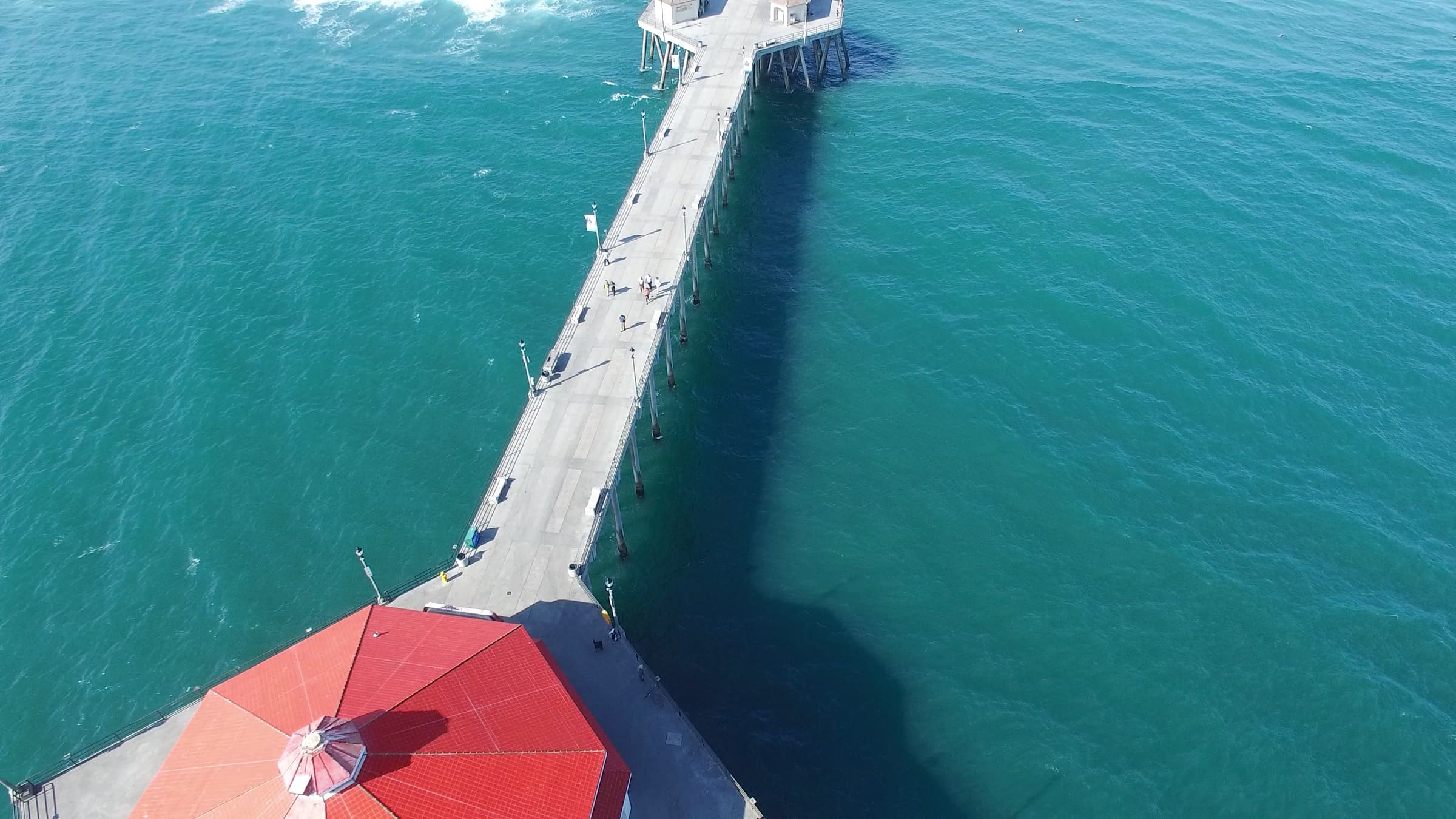
Because it hugs the shoreline, the strand gives you open water views the entire way, with the pier and Main Street as the natural midpoint. On a clear day you can see Catalina from several stretches. Wind usually picks up in the afternoon off the ocean, so riders heading north often plan to fight the headwind on the way out and let it push them home.
The path shares space with pedestrians, cyclists, and skaters, so pace and courtesy matter more than speed. Mornings are calmer and cooler, which is why runners and dog walkers favor the early hours before the beach crowds arrive. If you want the quietest experience, start before the main lots fill up.
Huntington Beach, in the heart of coastal Orange County, built much of its identity around this stretch of coast, and the beach path is where that shows up most clearly. For anyone learning the city, a slow trip up and down the strand is the fastest way to understand how the neighborhoods connect to the water.
What makes the Bolsa Chica Ecological Reserve loop worth the walk?
The Bolsa Chica Ecological Reserve sits on the north side of Huntington Beach in the 92649 ZIP, and it is one of the largest coastal wetlands remaining in Southern California. It is managed by the California Department of Fish and Wildlife, and the main loop trail runs roughly 1.5 miles of mostly flat, packed dirt and boardwalk around the inner bay. This is a nature walk, not a bike route, so it reads very differently than the paved strand a few minutes south.
Birdwatching is the main draw. The wetland is a stop on the Pacific Flyway, so depending on the season you may see egrets, herons, pelicans, terns, and shorebirds working the mudflats. A wooden footbridge near the Pacific Coast Highway parking lot is the usual starting point, and interpretive signs explain the tidal system and restoration work along the way.
Bikes are not allowed on the reserve trails, and dogs are kept out to protect the wildlife, so plan to go on foot. The longer Mesa trail on the inland side adds distance and a gentle rise if you want more than the inner loop. Early morning and the hours near high tide tend to bring the most bird activity.
Across the highway sits Bolsa Chica State Beach, which connects to the beach path, so some visitors pair a quiet wetland loop with a paved coastal ride. That contrast, a protected marsh on one side of the road and open ocean on the other, is a big part of what makes recreation in this corner of Huntington Beach distinct.
Which trails run through Huntington Central Park?
Huntington Central Park is the largest city park in Huntington Beach and one of the larger municipal parks in Orange County, covering roughly 350 acres a few miles inland from the coast. Its trail network is a mix of paved and soft-surface paths that wind past two lakes, open lawns, groves of mature trees, and the Shipley Nature Center. This is where you go when you want shade, quiet, and a break from the ocean wind.
The park is split into east and west sections divided by Golden West Street, and each side has its own loops and connectors. You will find paved walkways suitable for strollers and casual cycling, along with dirt paths that feel more like a true nature walk. Distances are flexible, so you can string together a short stroll around a lake or a longer multi-mile circuit.
Amenities make it easy to spend a morning here. There are restrooms, picnic areas, a dog park, a library, and the equestrian center on the edge of the park. The two lakes, Huntington Lake and Talbert Lake, give the loops a focal point and draw waterfowl year-round.
The Central Park area and the surrounding neighborhoods are a well-known part of residential Huntington Beach, and the park is a daily amenity for people nearby. If you are weighing where to live relative to trails, the parks, and the coast, the Huntington Beach communities overview is a useful place to start.
What can you see on the Santa Ana River Trail?
The Santa Ana River Trail is a paved, multi-use path that starts at the coast near the Huntington Beach and Newport Beach boundary and runs inland for roughly 30 miles of continuous riding, with long-term plans to extend it toward the mountains. It is one of the longest uninterrupted paved paths in the region, which makes it a favorite for cyclists who want distance without constant road crossings. The flat grade near the coast keeps the opening miles accessible for most riders.
Because the trail follows the river channel, it gives you a different view of Orange County than the shoreline does. You pass parks, open space, and quiet stretches away from traffic, and the path connects to several city trail systems along the way. Riders often use it as the inland leg of a loop that returns along the beach path.
The coastal trailhead is easy to reach from the south end of Huntington Beach, and it links the strand to the broader regional network. That connection means you can plan rides that start on the sand and head miles inland without sharing a lane with cars.
Water, sun protection, and a plan for the wind are the main things to bring, since shade is limited on the open stretches. For a long ride, mapping your turnaround point in advance helps you manage the afternoon headwind on the return.
How are the Shipley Nature Center paths different?
Shipley Nature Center is an 18-acre preserve tucked inside Huntington Central Park, and its paths are the gentlest, most contemplative walking in the city. The trails are short, flat, and shaded, winding past native plant habitats, a freshwater pond, and restored woodland. This is walking only, at a slow pace, with interpretive signage along the way.
The center focuses on native California habitats, so it functions as an outdoor classroom as much as a trail. You will see oak woodland, meadow, and wetland zones that the volunteer stewards have worked to restore over the years. It is a good counterpoint to the open, sun-exposed beach path when you want quiet and tree cover.
Hours are more limited than the open city park around it, so it is worth checking the current schedule before you go. Admission is typically free, and the paths are easy enough for almost any ability level. Because it is small, a full loop takes well under an hour at an easy stroll.
For anyone who prefers calm over cardio, Shipley offers a nature experience without a drive out of town. It sits within the same Central Park footprint, so you can combine it with the larger park loops for a longer outing.
Paved path or nature trail: which should you choose?
The simplest way to plan a day is to decide what you want from the outing, because Huntington Beach gives you two clear styles of trail. The paved routes are built for speed, distance, and ocean views, while the nature trails are built for quiet, wildlife, and shade. Neither is better, they just serve different moods.
Choose a paved path when you want to cover ground on a bike, push a stroller, skate, or run a flat timed loop. The 8.5-mile beach path and the Santa Ana River Trail are the headliners here, both smooth and mostly separated from traffic.
Choose a nature trail when you want to slow down, watch birds, and walk on dirt or boardwalk away from bike traffic. Bolsa Chica Ecological Reserve, Shipley Nature Center, and the soft-surface sections of Central Park all fit this category, and most do not allow bikes.
Many locals combine both in one trip, pairing a wetland walk at Bolsa Chica with a stretch of the beach path across the highway, or a Central Park loop with a slow pass through Shipley. The short distances between these spots make that easy to do in a single morning.
- Paved and fast: the 8.5-mile beach path and the Santa Ana River Trail, best for cycling, running, skating, and strollers
- Nature and quiet: Bolsa Chica Ecological Reserve, Shipley Nature Center, and the dirt paths in Central Park, best for walking and birdwatching
- Mixed terrain: Huntington Central Park, which offers both paved loops and soft-surface trails in one place
- Wind-aware planning: on the open coastal and river paths, head out into the afternoon headwind and let it push you home
Where can you park and access the trails?
Access points are spread across the city, so your starting lot usually depends on which trail you are after. For the beach path, the main metered and paid lots run along Pacific Coast Highway near the pier and up at Bolsa Chica State Beach on the north end. These fill quickly on warm weekends, so arriving early makes a real difference.
For the Bolsa Chica Ecological Reserve, there is a dedicated lot on Pacific Coast Highway across from the state beach, right at the footbridge trailhead. It is a small lot, and it is the most direct way onto the inner loop. The inland Mesa side has separate street access off Warner Avenue.
Huntington Central Park has several free lots off Golden West Street, Talbert Avenue, and Slater Avenue, which spread visitors across the east and west sections. The Santa Ana River Trail is reachable from the coastal trailhead near the south city limit and from multiple parks along the river channel inland.
Fees and hours change, so checking the City of Huntington Beach and California Department of Fish and Wildlife sites before you go saves hassle. If you are new to the area and trying to understand how these access points relate to different parts of town, the Huntington Beach area guide gives you the lay of the land.
Where can you rent bikes in Huntington Beach?
If you do not have a bike, rentals are available near the coast, which makes the beach path easy to enjoy without owning gear. Several rental stands operate near the Huntington Beach Pier and along the Main Street corridor, offering beach cruisers, multi-speed bikes, tandems, and surreys suited to the flat strand. Hourly and daily rates are common, and many also rent for groups.
Beach cruisers are the natural match for the paved beach path, since the route is flat and the pace is relaxed. If you plan to ride the longer Santa Ana River Trail, a geared bike is more comfortable over distance. Ask about helmets and locks when you rent, and confirm the shop's hours against sunset if you are starting late in the day.
Rental availability is strongest in the warmer months and on weekends, so calling ahead during peak season can save you a wait. Prices and inventory vary by shop, and this guide does not endorse any single operator. Compare a couple of nearby options and pick what fits your ride.
For a first visit, renting near the pier and riding the strand in both directions is the easiest introduction to Surf City recreation. It gives you the coastal highlights with almost no planning.
Which trails rank best for distance and difficulty?
Trail choice often comes down to how far you want to go and how much effort you want to spend. The routes below are ordered from easiest to most demanding, so you can match a trail to your energy and the time you have. All of them sit within or next to Huntington Beach in coastal Orange County.
- Shipley Nature Center, easiest: short, flat, shaded loops of well under a mile, walking only, ideal for a slow nature stroll
- Bolsa Chica Ecological Reserve loop, easy: about 1.5 miles of flat dirt and boardwalk, walking only, best for birdwatching
- Huntington Central Park loops, easy to moderate: flexible paved and soft-surface distances around two lakes, good for walkers, strollers, and casual riders
- Huntington Beach beach path, moderate: roughly 8.5 miles one way of flat pavement with afternoon ocean wind as the main challenge
- Santa Ana River Trail, moderate to demanding by distance: up to about 30 miles of paved riding inland, flat grade but long, best on a geared bike
How do trails and coastal recreation shape life across Huntington Beach?
Trail access is one of the practical reasons people are drawn to different parts of Huntington Beach, and it looks different depending on where you are in the city. Homes near the coast sit close to the beach path, while the Central Park area puts the city's largest trail network and its lakes within easy reach. Up north, the Bolsa Chica wetlands and Huntington Harbour give the area a quieter, water-oriented feel.
Justin Ratowsky grew up here and has lived in many of these neighborhoods, which is why the team talks about the city block by block rather than as one place. The stretch near Central Park has its own rhythm, the harbour has another, and Sunset Beach feels different again. Knowing how each pocket connects to the trails, the parks, and the water is the kind of local detail Justin brings to a conversation about where to look.
Craig and Justin Ratowsky work across coastal Orange County, from inland neighborhoods near Central Park to waterfront streets in Huntington Harbour. If trail access and proximity to the coast matter in your search, those details are easy to factor into where you look. The buyer guide for Huntington Beach and the waterfront homes guide both touch on how location shapes daily life here.
None of this is about who should live in a given area, just how the geography and recreation connect. Understanding that map early makes it easier to narrow your search when you are ready. If you want to talk it through, the contact page is the place to start.
Frequently asked
Best Walking and Biking Trails in Huntington Beach, the questions we hear first.
How long is the Huntington Beach beach bike path?
Is the Bolsa Chica Ecological Reserve free to walk?
Where can you rent bikes near the Huntington Beach Pier?
Can you bike from Huntington Beach to Newport Beach?
Is the Santa Ana River Trail paved the whole way?
Are dogs allowed on Huntington Beach trails?
Your Huntington Beach real estate team
Craig and Justin Ratowsky.
Craig Ratowsky and Justin Ratowsky are equal partners at Ratowsky Group, principal agents with Compass, and founding members of the Compass Huntington Beach office. Craig has sold Huntington Beach real estate since 1977, bringing 49 years of pricing and negotiation experience. Justin is a third-generation California Realtor® focused on local guidance and modern marketing. Together, they bring 58+ years of combined experience.
Sources & local citations
- City of Huntington Beach, parks and beaches information
- California Department of Fish and Wildlife, Bolsa Chica Ecological Reserve
- California Coastal Commission
Qualitative claims framed as agent insight reflect Ratowsky Group’s direct experience and are not represented as third-party verified data.
Start the search
Exploring Huntington Beach on foot and on two wheels
If you are getting to know Huntington Beach and want to understand how the trails, parks, and coast connect to different neighborhoods, Craig and Justin Ratowsky are happy to talk it through. It is a local, no-pressure conversation, just useful information for whenever your move takes shape. The [contact page](/contact) is the easiest place to start.
Ratowsky Group at Compass. Craig Ratowsky DRE #00608046, Justin Ratowsky DRE #02026158. Guidance is general market context, not a valuation, tax, or legal advice.